uw-cert-15

uw-cert-15
0 0
uw-cert-15
Presentation for CUGOS participating in the 2015 UW Cert program talksOn Github aaronr / uw-cert-15
Open Source GIS
Aaron Racicot - aaronr@z-pulley.com reprojected.com / @reprojected github.com/aaronr aaronr.github.io/uw-cert-15
People are computer literate when they understand software is not a product
Who I am?
- SW Developer
- Environmental Scientist
- Open Source Advocate
Computer Science
Bridging the Gap
Environmental Science
Day Job - NOAA
Fun Job - CUGOS
The Deepwater Horizon experience
Our project...
Environmental
Response
Management
Application
What is ERMA?
DWH - By the numbers
- 11 men perished
- 200+ million gallons of oil spilled
- 580+ miles of shoreline oiled
- 1.70+ million gallons dispersants applied
- 400+ controlled burns
- 4+ million feet of containment boom and 9+ million feet of sorbent boom
DWH and ERMA
- Over 180 Individual Federal/State GIS Staff
- 30-40 specifically ERMA (up from 4 normally)
- 3 ERMA developers
ERMA Shines as COP
- Less than 48 hours to deploy
- Scalable – 1400+ response users, 16,000+ layers (DWH)
- 30,000+ layers today
- Nimble – over 850 code commits in DWH first year
- Public ERMA – over 20 million hits in 24 hours!
Common Operational Picture (COP)
Continued push toward multi-agency
cooperation and data sharing
Scaling in new ways
(leveraging the cloud)
So how/why does this matter to you?
The nuts and bolts might not...
the philosophy does
Focus on small teams of experts
Leverage open tools,
but own the deployment
- This gives us the benefit of a large community of developers
- This gives us the freedom modify and adapt when needed
Utilize open data
and open standards
Doing more with less
(This is a good investment for NOAA)
David Shean "Ice Man" http://psc.apl.washington.edu/wordpress/people/students/david-shean/
CUGOS "Google Guys"
Video the bikes!
Hardware options...
Fully DIY
Big Crazy Scary
I choose low cost RTF (Ready To Fly) and then Hack It!
Phantom FC40 (~$450)
FPV camera (FC40)(720p)
Canon (elph 130 16MP) downward facing (CHDK) (~$130)
Flytrex Data Logger (~$50)
CHDK
Prop Guards + Extra battery + Camera mount(~$50)
"The Rig"
Gimbal
Why is this so interesting now...
$$$$$ Cheap $$$$$
Technology is easy to use
FUN!
Where is it OK to fly https://www.mapbox.com/drone/no-fly/
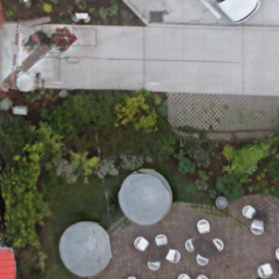
Video taken with my rig...
Workflow #1
Panoramic image stitching... as good as Google gets
200 of these
ICE
AgiSoft
Workflow #2
OSM data creation / Web MapsQGIS Warper
MapKnitter http://mapknitter.org/
nearblack -of GTiff -setalpha -o outfile infile
gdal2tiles.py --profile=mercator -z 1-22 yourmap.tif outputfolder
git checkout gh-pages
git add outputfolder
git commit -m "Yes... TILE DATA"
git push
http://langleywa.github.io/gisdata/tiles/langley-2nd-street-2014/21/335500/1368498.png
Tiles into your App!
Edit in OSM http://ideditor.com/ https://www.openstreetmap.org/edit?editor=id#map=19/48.03979/-122.40668 http://langleywa.github.io/gisdata/tiles/langley-2nd-street-2014-tms/{z}/{x}/{y}.png
Workflow #3
3D from Structure from Motion (SFM)Load image batches
Matching
Visual SFM Sparse Point Cloud
Dense Point Cloud
MeshLab
AgiSoft Sparse Point Cloud
Dense Point Cloud
Textured Mesh
More Examples
Flying Brightwater Treatment Plant
Flight Paths
Photoscan SFM Rendering
Chewy
School
Farm
Compare (PhotoScan vs VSFM)
The Future
Automation, DEM's, 3D printing, etcAutomation (OpenDroneMap)
OpenDroneMap working hard!
DEM's
3D Print Example (Chris Schmidt)
Point Cloud
Mesh
Print Prep
My Story
* Develper turned Environmental Scientist *
* Many turn from Science to Development *
Key is that we all meet in the middle!
Open Source GIS is a
great path to bridge the gap
My Advice
Dev chops are the differentiator
My kids are learning Python...
in 1st grade!
Choose a stack and become an expert
- (os) Linux
- (database) Postgresql/PostGIS
- (render) Mapserver/Mapnik
- (cache) TileCache/TileStache
- (frontend) MapBox/Leaflet/OpenLayers
All the rest are an easy jump
Learn to code... and script...
- (backend) Shell Scripting, Python, Javascript
- (frontend) Javascript, HTML, CSS
- (code management) GIT, GitHub
- (editing) Emacs, VIM